
Late Quaternary Relative Sea-Level Reconstruction Using Sea-Level Index Points (SLIPs)
During my postdoctoral research at Xiamen University, I utilized SLIPs as reference markers to analyze historical sea-level fluctuations. SLIPs, which commonly include geological or geomorphological features, as well as archaeological evidence, function as dependable indicators of past sea levels. By examining the elevation and distribution of these SLIPs, I was able to reconstruct the fluctuations in sea levels over time, thereby offering valuable insights into Earth’s geological and environmental history.
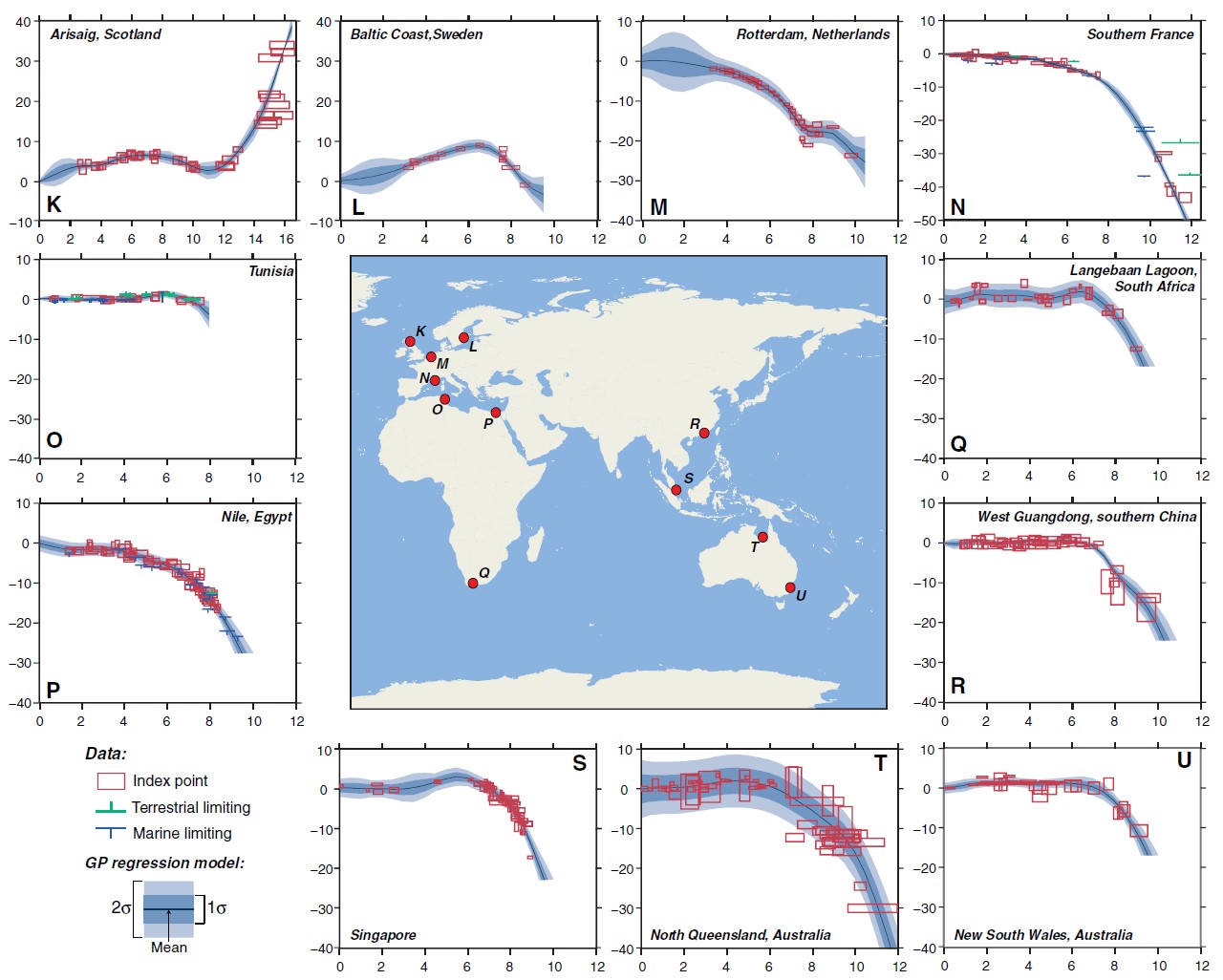 Figure. Selected relative sea-level reconstructions. (after [Khan et al., 2015](https://doi.org/10.1007/s40641-015-0029-z)).
 Selected references
- Yu, F., Li, N., Tian, G., Huang, Z., Xiong, H., Li, T., Liu, S. and Liu, Y., 2023. A re-evaluation of Holocene relative sea-level change along the Fujian coast, southeastern China. Palaeogeography, Palaeoclimatology, Palaeoecology 622: 11577. [link]